Hoggar Mountains
Highland region in the central Sahara, southern Algeria.

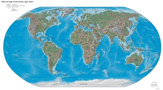
The Hoggar Mountains (Arabic: جبال هقار, romanized: Jibāl Haqqār; Berber: idurar n Ahaggar) are a highland region in the central Sahara in southern Algeria, along the Tropic of Cancer, that covers an area of approximately 550,000 km2. The mountains are home to the Ahaggar Cultural Park (from 1987 to 2011 Ahaggar National Park). The tallest peak in the range and Algeria, Mount Tahat, is located in the park area, which covers approximately 450,000 square kilometres (170,000 sq mi).
- area
- The mountain range covers an area of approximately 550,000 km2. The Ahaggar Cult
Verified Timeline
Lore & Background
This mountainous region is located about 1,500 km (930 mi) south of the capital, Algiers. The area is largely rocky desert with an average elevation of more than 900 m (3,000 ft) above sea level. The highest peak, Mount Tahat, is at 2,908 m (9,541 ft). The mountains are primarily composed of metamorphic rock approximately 2 billion years old although there are areas in which more recent volcanic activity has laid down much newer rock. Several of the more dramatic peaks, such as Ilamen, are the result of erosion wearing away extinct volcano domes, leaving behind the more resistant material that plugged the volcanic cones. Assekrem is a famous and often-visited point, where Charles de Foucauld built a hermitage in 1911. The highlands are believed to be one of the main sources of the Tamanrasset River, an ancient river that flowed during the African humid period and was named after the main city nearby, Tamanrasset. The city was built in a desert valley, or wadi, that was part of the ancient watercourse.
Reader's Guide
The Hoggar Mountains range typically experiences hot summers, with a cold winter climate. Temperatures fall below freezing over winter nights. Rainfall is rare and sporadic year-round. However, since the climate is less extreme than in most other areas of the Sahara, the mountains are a major location for biodiversity, including a number of relict species. The mountains are part of the West Saharan montane xeric woodlands ecoregion. Vegetation in this area includes trees such as Vachellia tortilis, Vachellia seyal, myrtle and Tamarix aphylla which are scattered throughout the area. Other plants may include Citrullus colocynthis and Calotropis procera. Slightly to the west of the Hoggar range, a population of the endangered African wild dog (Lycaon pictus) remained viable into the 20th century, but is now thought to be extirpated within this entire region. Relict populations of the West African crocodile persisted in the Hoggar Mountains until the early 20th century. Analysis of collected scat in 2006 showed the presence of the Northwest African cheetah in the region. Between August 2008 and November 2010, four individuals were recorded by camera traps. A single cheetah was filmed and photographed by Algerian naturalists in 2020 in the national park in the Atakor volcanic field. The park also contains a population of herbivores such as the saharan subspecies of the barbary sheep and the Dorcas gazelle. The park has been designated an Important Bird Area (IBA) by BirdLife International because it supports significant populations of spotted, crowned and Lichtenstein's sandgrouse, pharaoh eagle-owls, pallid harriers, greater hoopoe-larks, bar-tailed and desert larks, pale rock martins, fulvous babblers, white-crowned and mourning wheatears, desert sparrows and trumpeter finches. Prehistoric settlement is evident from extant rock paintings dating to 6000 BC. The Hoggar Massif is the land of the Kel Ahaggar Tuareg. The tomb of Tin Hinan, the woman believed to be the matriarch of the Tuareg, is located at Abalessa, an oasis near Tamanrasset. The hermitage of Charles de Foucauld, which continues to be inhabited by a few Catholic monks, is at the top of the Assekrem plateau in the Hoggar Mountains. Underground atomic tests were conducted by France in the mountains in the 1960s.
Did You Know?
- The Hoggar Mountains cover an area of approximately 550,000 km2.
- Mount Tahat, at 2,908 m (9,541 ft), is the tallest peak in both the range and Algeria.
- Charles de Foucauld built a hermitage at Assekrem in 1911, which is still inhabited by a few Catholic monks.
- Analysis of collected scat in 2006 showed the presence of the Northwest African cheetah in the region.
- Underground atomic tests were conducted by France in the mountains in the 1960s.
Ancient Geology and Dramatic Landforms
The Hoggar Mountains rise from the central Sahara in southern Algeria, stretching across roughly 550,000 square kilometres along the Tropic of Cancer, about 1,500 kilometres south of Algiers. The highlands sit at an average elevation exceeding 900 metres, with the terrain predominantly rocky desert. The bedrock story stretches back approximately two billion years, consisting largely of metamorphic rock, though pockets of far more recent volcanic activity have deposited newer geological layers across the landscape. Some of the most striking peaks, including Ilamen, owe their dramatic silhouettes to a process of erosion that gradually stripped away the softer material of extinct volcanic domes, exposing the harder plugs that once sealed the cones. The range's summit, Mount Tahat, reaches 2,908 metres, making it the highest point not only in the Hoggar but in all of Algeria. This combination of ancient crystalline foundations and younger volcanic scars gives the mountains a geological depth that few other desert landscapes can match.
A Refuge of Life in the Sahara
Although rainfall in the Hoggar is rare and sporadic throughout the year, the highlands' climate is noticeably less punishing than that of the surrounding Sahara, making the range a critical refuge for biodiversity. The area falls within the West Saharan montane xeric woodlands ecoregion and supports scattered stands of Vachellia tortilis, Vachellia seyal, myrtle, and Tamarix aphylla, alongside species such as Citrullus colocynthis and Calotropis procera. Among the animals, the park shelters populations of the Saharan subspecies of barbary sheep and Dorcas gazelle. Perhaps most remarkably, the Northwest African cheetah has been documented here: scat analysis in 2006 confirmed its presence, camera traps recorded four individuals between 2008 and 2010, and Algerian naturalists filmed a single cat in the Atakor volcanic field in 2020. Less fortunate are the African wild dog, once viable just west of the range into the twentieth century but now believed extirpated, and the West African crocodile, which persisted in the mountains until the early 1900s. BirdLife International has designated the park an Important Bird Area, citing significant populations of numerous sandgrouse, raptors, and other desert-adapted species.
Layers of Human Inhabitation and Faith
Evidence of human presence in the Hoggar reaches back to at least 6000 BC, as shown by surviving rock paintings scattered across the massif. The mountains are the ancestral homeland of the Kel Ahaggar Tuareg, and the region holds deep spiritual significance for them: the tomb of Tin Hinan, regarded as the matriarch of the Tuareg people, rests at Abalessa, an oasis near the city of Tamanrasset. Another profound human imprint is the hermitage that Charles de Foucauld constructed on the Assekrem plateau in 1911. This site, perched high in the mountains, has continued to be occupied by a small community of Catholic monks, making it one of the most remote and enduring religious presences in the Sahara. The city of Tamanrasset itself was established in a desert valley, or wadi, that formed part of the ancient Tamanrasset River—a watercourse that flowed during the African humid period and is believed to have originated in these highlands. Together, these layers of prehistoric art, Tuareg heritage, and Christian monasticism illustrate a landscape where human meaning has been inscribed over millennia.
Conservation, Conflict, and Modern Legacy
The Hoggar Mountains carry a complex modern history that intertwines conservation with military history. In the 1960s, France conducted underground atomic tests within the range, leaving a shadow over an area now dedicated to preservation. The protected area, known as the Ahaggar National Park from 1987 to 2011 and subsequently reclassified as the Ahaggar Cultural Park, encompasses approximately 450,000 square kilometres and includes Mount Tahat, Algeria's highest peak. The park's ecological importance is underscored by its status as an Important Bird Area and its role as the last stronghold for the critically rare Northwest African cheetah in the region. The broader landscape also preserves traces of a once-thriving hydrological system: the highlands are considered a primary source of the Tamanrasset River, an ancient waterway active during the African humid period whose course shaped the settlement patterns of the surrounding desert. Today, the park stands as both a living cultural landscape for the Tuareg and a fragile ecological sanctuary, balancing the weight of its past with the urgent need to protect the species and traditions that still endure within its vast boundaries.
Frequently Asked Questions
Where are the Hoggar Mountains located?
The Hoggar Mountains form a highland region in the central Sahara, situated in southern Algeria just north of the Tropic of Cancer.
What is the tallest peak in the Hoggar Mountains?
Mount Tahat, standing at 2,908 metres (9,541 ft), is the highest point in both the Hoggar range and the entire country of Algeria.
What is the Ahaggar Cultural Park?
It is a protected zone within the Hoggar region that was first established as Ahaggar National Park in 1987 and later redesignated as a cultural park in 2011.
How large is the Hoggar Mountains area?
The Ahaggar Cultural Park spans roughly 50,000 square kilometres, although the broader mountain range extends well beyond that designated boundary.
Why are the Hoggar Mountains significant?
They are one of the most prominent highland features in the otherwise flat central Sahara and serve as a cultural and ecological refuge in southern Algeria.
More in Mountains And Mountain Ranges 25-32
Elsewhere in the Mountains And Mountain Ranges universe
Spotted an error? Know more?
This is a living reference — every entry is fact-audited, and reader corrections feed straight into our audit queue. Suggest an edit · See this site's audit record